

Drooniluba.ee – drone flight planning starts here
Before taking off with a drone, a simple question often arises: may I fly here? The answer depends on the location, altitude, time and conditions in force in that area. There is now a short, easy-to-remember address for checking: Drooniluba.ee.
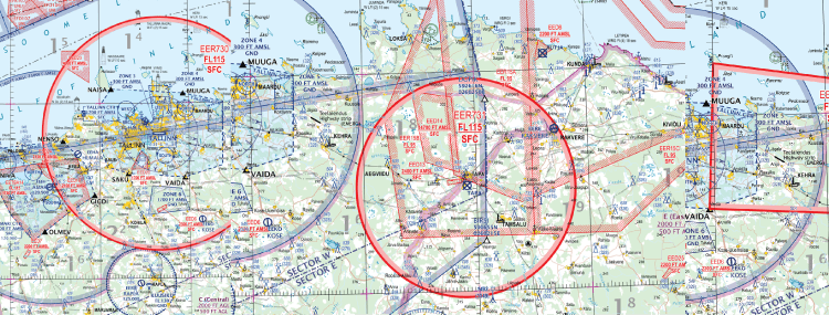
We have created a convenient starting point for drone pilots, where you can open the Estonian drone map and check flight area conditions before flying. The site helps you identify geographical zones, altitude restrictions and temporary NOTAMs displayed on the map. If a term is unclear, the FAQ and NOTAM guide provide straightforward explanations.
According to an estimate published by the Estonian Transport Administration in 2025, Estonia may have had 30,000–40,000 drones. The number of drones is not the same as the number of pilots, but it shows why both beginners and experienced pilots need a simple tool for checking local flight conditions before take-off.
How do you use Drooniluba.ee?
- Find your flight location. Open drone map and find the place where you want to fly.
- Check the conditions. Read the area description, check altitude limits and see whether any relevant notices apply during your flight.
- Check whether permission is needed. If the area or planned flight requires coordination or permission, follow the map’s instructions and contact the competent authority.
Drooniluba.ee aims to make flight preparation easier to understand. The map application and airspace data come from Estonian Air Navigation Services; before each flight, the pilot must check the conditions applicable to that location and time.
To learn more about using the drone map, NOTAMs and flight rules, explore Droonimaailm drone courses.