
 Kuumakse al.
 | Kaal | 1,15 kg |
|---|---|
| Mõõtmed | 18,2 × 10,7 × 21,5 cm |
| EAN | |
| Tootja | |
| Drone product line | |
| Model name | Phantom 4 RTK SDK Remote Controller/Phantom 4 RTK SDK Remote Controller |
| Shipping box quantity | |
| Shipping Box Depth (cm) | |
| Shipping Box Height (cm) | |
| Shipping Box Weight (kg) | |
| Shipping Box Width (cm) | |
| Unit Brutto Volume (cubm) | |
| Unit Net Weight (kg) | |
| Unit Gross Weight (kg) | |
| Unit Box Width | |
| Unit Box Length | |
| Unit Box Height |

DJI Phantom 4 RTK SDK Remote Controller
725,00 €
Out of Stock2
Saadavus: Laost otsas
The use of commercial drones has increasingly become common practice for the survey industry. This comes as no surprise since drone mapping has proven to yield significant benefits when compared to traditional methods, with companies such as The Beck Group seeing a 25% reduction of rework across projects after using this technology. As surveyors and large construction contractors have turned to DJI platforms as a new tool for collecting survey data, the open nature of software on DJI drone platforms has spawned a new generation of software providers producing compatible photogrammetry and automated mapping software. To further enhance these developments, DJI is pleased to announce the Phantom 4 RTK SDK Remote Controller, which is Mobile SDK compatible – meaning, pilots with experience using 3rd party applications on DJI drones can now access the world's leading drone app ecosystem for their Phantom 4 RTK with the SDK remote controller.
Laost otsas
VõrdleSarnased tooted
-
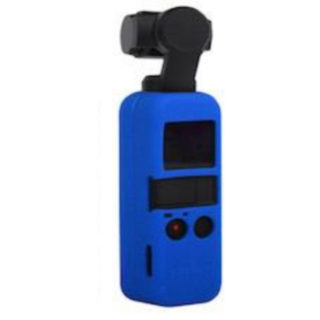
DJI Osmo Pocketi silikon kaitse sinine
DJI Osmo Pocketi silikon kaitse sinine Details Package weight: 0.060kg Silicone Protection With Lanyard Weight: 41g For DJI OSMO Pocket
-
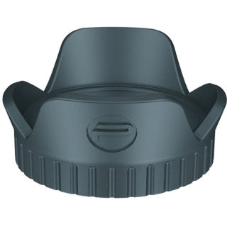
Lens Hood for DJI Osmo Action camera
Lens Hood for DJI Osmo Action camera PGYTECH OSMO Action Lens Hood effectively protects the lens from stray sunlight without blocking the field of view. Features soft rubber that ensures […]
-
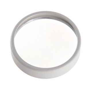
DJI Phantom 4 Quadcopter UV Filter – Part 37
This filter will protect the DJI Phantom 4 camera lens from potentially harmful UV rays by reducing the level of ultraviolet light it lets through. This filter is included with […]
-
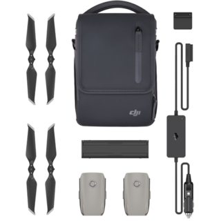
DJI Mavic 2 Enterprise Fly More Kit
The Mavic 2 Enterprise Fly More Kit from DJI includes a host of additional accessories for your Mavic 2 Enterprise drone. This kit features two self-heating flight batteries, a cable […]